A public sign at the Franchthi cave provides information about the geography of the area.
The sigh reads:
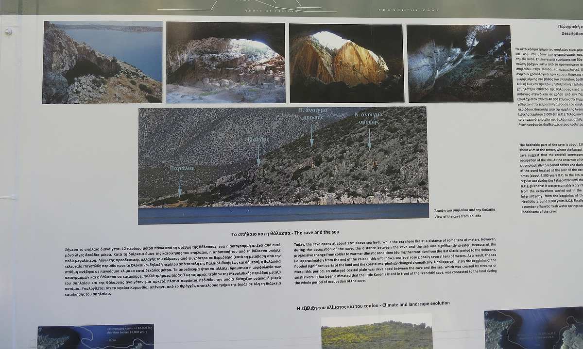
The cave and the sea
"Today, the cave opens at about 12m above sea level, while the sea shore lies at a distance of some tens of meters. However, during the occupation of the cave, the distance between the cave and the sea was significantly greater. Because of the progressive change from colder to warmer climatic conditions (during the transition from the last Glacial period to the Holocene, I.e. approximately from the end of the Palaeolithic until now), sea level rose globally several tens of meters. As a result, the sea flooded significant parts of the land and the coastal morphology changed dramatically. Until approximately the beggining of the Mesolithic period, an enlarged coastal plain was developed between the cave and the sea, which was crossed by streams or small rivers. It has been estimated that the little Koronis Island in front of the Franchthi cave, was connected to the land during the whole period of occupation of the cave."
Description and history of the cave:
"The habitable part of the cave is about 150m long, while its width ranges from about 30m at the entrance to about 45m at the center, where the largest "window" is located. Surface finds and two test pits at the rear of the cave suggest that the rockfall corresponding to this window occured at or near the end of the Neolithic occupation of the site. At the entarnce of the cave, archaeological data prove that the rockfall on this spot belong chronologically to a period before and during the Neolithic (about 7,000-3,000 years B.C.). Near and at the bottom of the pond located at the rear of the cave, potsherds and other artefacts of Final Neolithic to Early Byzantine times (about 4,500 years B.C. to the 6th century A.D.) have been found. This part of the cave may have been in regular use during the Palaeolithic until the Early Neolithic period (at least from 40,000 years to the 8th millenium B.C.), given that it was presumably a dry cavity, when sea level was much lower than today. According to the data from the excavations carried out in the chamber at the front of the cave, prehistoric people used this area Intermittently from the beggining of the Upper Palaeolithic (around 40,000 years B.C.) until the end of the Neolithic (around 3,000 years B.C.). Finally, near the cave, along the coastline and just below the current sea level, a number of karstic fresh water springs can been found. Some of them must have been available to the prehistoric inhabitants of the cave."
Franchthi Cave. Peloponnese, Greece.