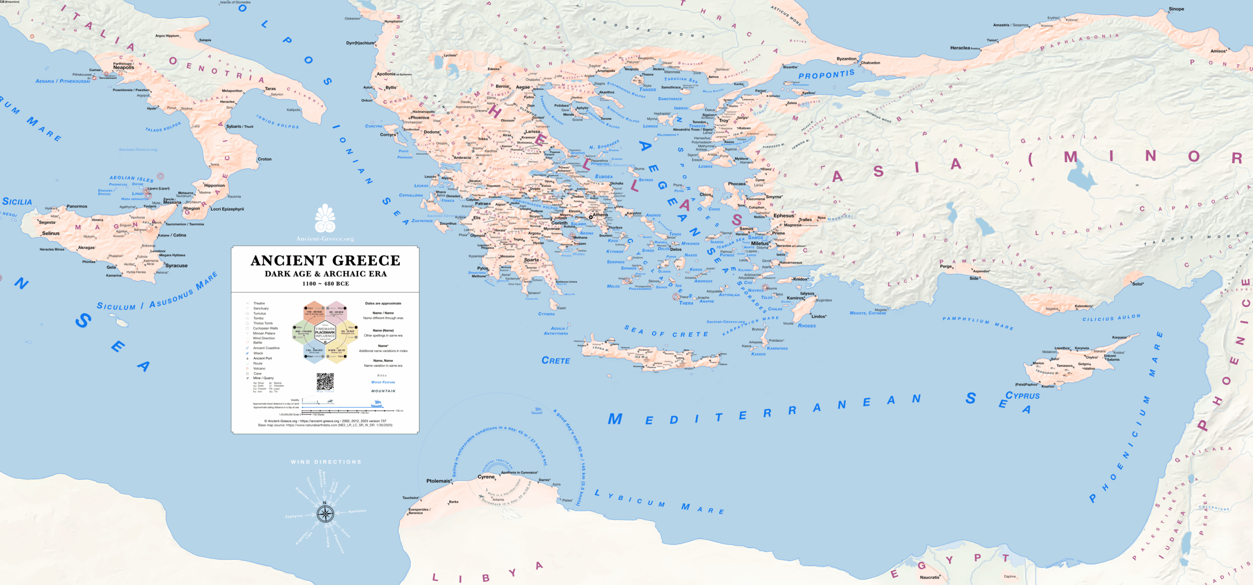
Map of Dark and Archaic Age Greece
Greece
1100-480 BCE
(Archaic)
Digital
Aegean settlement patterns and early city-state formation.
Download the high resolution file
Κατεβάστε το αρχείο υψηλής ανάλυσης
The map illustrates the transition from the post-palatial period to the consolidation of the Greek polis. It tracks the movement of populations and the establishment of major settlements across the Aegean and the Mediterranean during the Archaic era. It provides a geographic foundation for understanding the rise of independent city-states prior to the Persian Wars.
◈ ◈ ◈
Χάρτης της Ελλάδας των Σκοτεινών Χρόνων και της Αρχαϊκής Εποχής
Ελλάδα
1100-480 π.Χ.
(Archaic)
Ψηφιακό Μέσο
Πρότυπα οικισμών και σχηματισμός των πρώτων πόλεων-κρατών στο Aegean.
Ο χάρτης είναι διαθέσιμος και στα ελληνικά.
Directory | Κατάλογος
Database with the index of every place on the map with additional spellings and information.
◈ Βάση δεδομένων με το ευρετήριο κάθε τοποθεσίας στον χάρτη, με επιπλέον γραφές και πληροφορίες.
Sources | Πηγές
General map sources may be found in the bibliography.
◈ Γενικές πηγές βρίσκονται στη βιβλιογραφία.