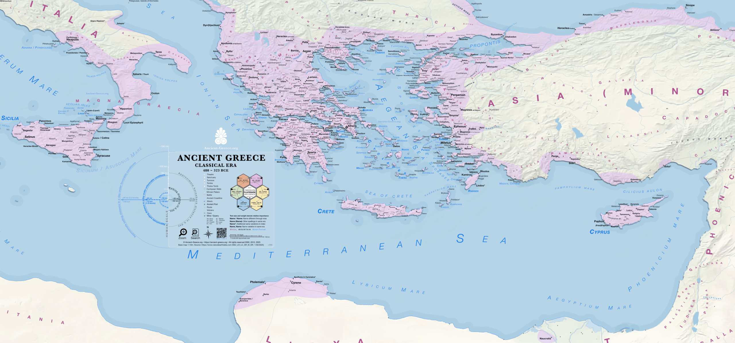
Map of the Eastern and Central Mediterranean in the Classical Era
Central and Eastern Mediterranean Basins
480-323 BCE
(Classical)
Digital
Greek settlement distribution and maritime reaches from Italy to the Levant.
The map documents the extent of the Hellenic world during the Classical period, focusing on the concentration of active sites across the Central and Eastern Mediterranean. It identifies the major urban centers and colonial foundations throughout Italy, Sicily, and Libya, alongside the established networks in Asia Minor, Cyprus, and the Levant. The cartography emphasizes the geographical cohesion of these regions during the height of the poleis, providing a spatial record of Greek habitation from the Persian Wars to the campaigns of Alexander the Great.
◈ ◈ ◈
Χάρτης της Κεντρικής και Ανατολικής Μεσογείου κατά την Κλασική Εποχή
Λεκάνη της Κεντρικής και Ανατολικής Μεσογείου
480-323 π.Χ.
(Classical)
Ψηφιακό Μέσο
Κατανομή των Greek οικισμών και θαλάσσια εμβέλεια από την Ιταλία έως το Levant.
Ο χάρτης καταγράφει την έκταση του Hellenic κόσμου κατά την Classical περίοδο, εστιάζοντας στη συγκέντρωση των ενεργών τοποθεσιών στην Κεντρική και την Ανατολική Μεσόγειο. Προσδιορίζει τα κύρια αστικά κέντρα και τις αποικιακές εγκαταστάσεις σε όλη την Ιταλία, τη Σικελία και τη Libya, παράλληλα με τα εγκατεστημένα δίκτυα στη Μικρά Ασία, την Κύπρο και το Levant. Η χαρτογράφηση δίνει έμφαση στη γεωγραφική συνοχή αυτών των περιοχών κατά την ακμή των πόλεων, παρέχοντας ένα χωρικό αρχείο της ελληνικής κατοίκησης από τους Περσικούς Πολέμους έως τις εκστρατείες του Alexander the Great.
Directory | Κατάλογος
Database with the index of every place on the map with additional spellings and information.
◈ Βάση δεδομένων με το ευρετήριο κάθε τοποθεσίας στον χάρτη, με επιπλέον γραφές και πληροφορίες.
Sources | Πηγές
General map sources may be found in the bibliography.
◈ Γενικές πηγές βρίσκονται στη βιβλιογραφία.