Χάρτης της Αρχαίας Ελλάδας κατά την Κλασική Εποχή. 480 εως το 323 πΧ. v735 thumbnail
×
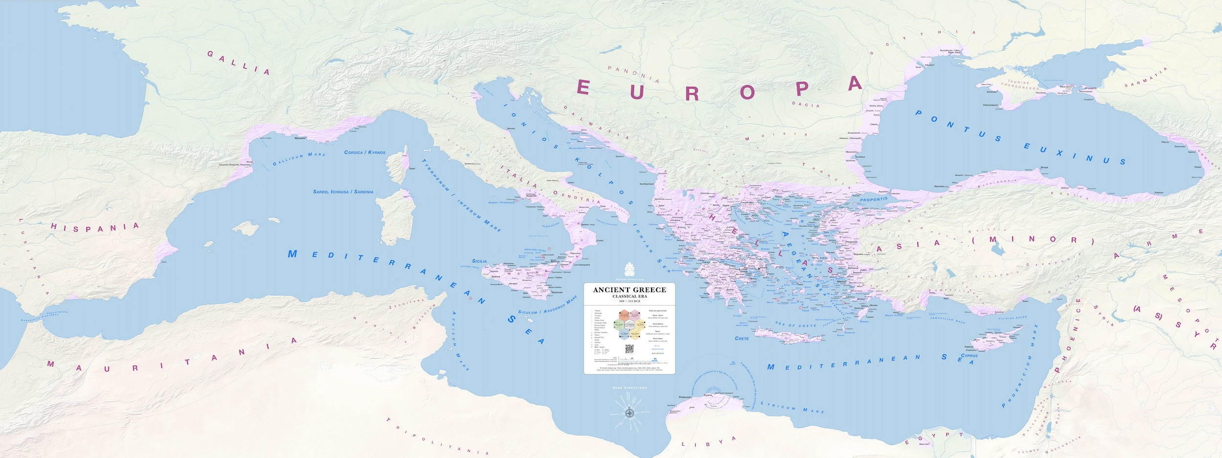
Χάρτης της Αρχαίας Ελλάδας κατά την Κλασική Εποχή. 480 εως το 323 πΧ. v735 thumbnail
Χάρτης της Αρχαίας Ελλάδας κατά την Κλασική Εποχή. 480 εως το 323 πΧ.
This is a JPEG thumbnail of the map. Please use the corresponding PDF map for better zooming, word searching, and printing:
Legend, index and sources
Use QR code for the map index of places.
Sources:
General map sources may be found in the bibliography.
Γεννικές πηγές θα βρήτε στην βιβλιογραφία.
Υπόμνημα και περιεχόμενα:
Χρησιμοποιήστε το QR code για τα περιεχόμενα του χάρτη.
Tags:
Classical
VIEW FULL SIZE ORIGINAL
Classical