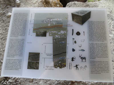
This public information sign is on display at Franchthi Cave archaeological site in Peloponnese, Greece.
The sign reads:
“The present view and extent of the cave is not the same as that during its prehistoric occupation. The further back we go in time, the lower the floor was and con-sequently, more spacious the chamber.
Over time, various materials have been deposited on the cave floor, resulting in its gradual rise. Some of these were of natural origin, such as rocks from the walls and roof, dust blown in by the wind or clay transported by water percolating through the roof. All of these contributed to the formation of geological layers.
In addition, archaeological material such as the remains of meals, tools, ash from hearths, constructions debris and refuse were incorporated within the layers. In order to study the evolution of the cave and especially the history of its use by humans, archaeologists excavated deep vertical trenches. In this way the layers mentioned above appear in section and can be “read” in chronological order, from the oldest at the bottom, to the youngest at the top. In front of you, Trench H-H1 reached a maximum depth of 9.71m, revealing a succession of layers from the Upper Palaeolithic to the end of the Neolithic.
In the following illustration, the northern face of the Trench is shown with its main chronological subdivisions.
Particular archaeological layers are numbered and accompanied by photographs on the left.
To the right, each chronological subdivision is linked to key technological and subsistence markers, which are characteristic of each period.”


