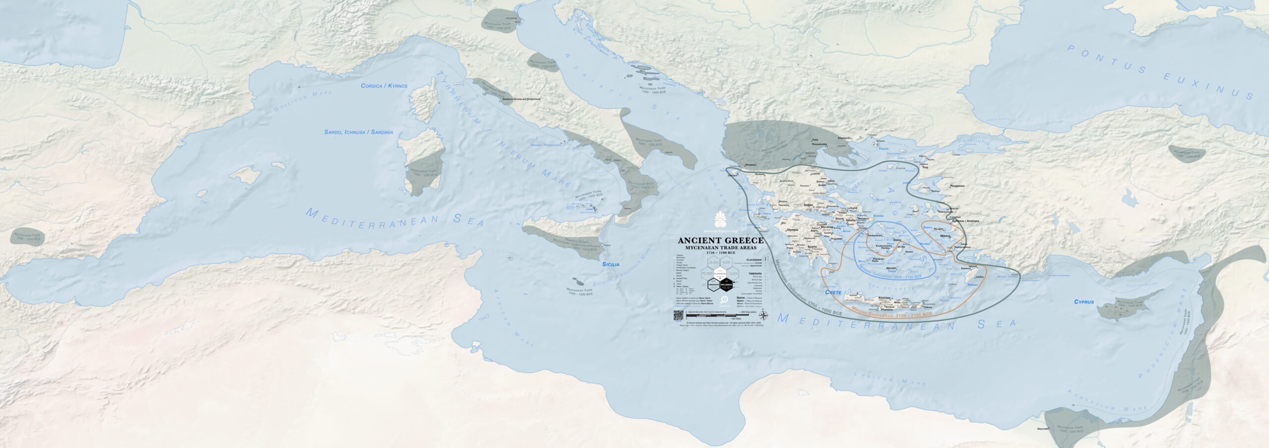
Map with the extend of the Aegean Bronze Age civilizations marked along with the locations of Mycenaean trade around the Mediterranean. These are locations where Mycenaean pottery was found (spanning from Spain to Sudan).
This is a JPG thumbnail.The PDF map is good for: print, zoom, search.
Sources in the bibliography.