On this page:
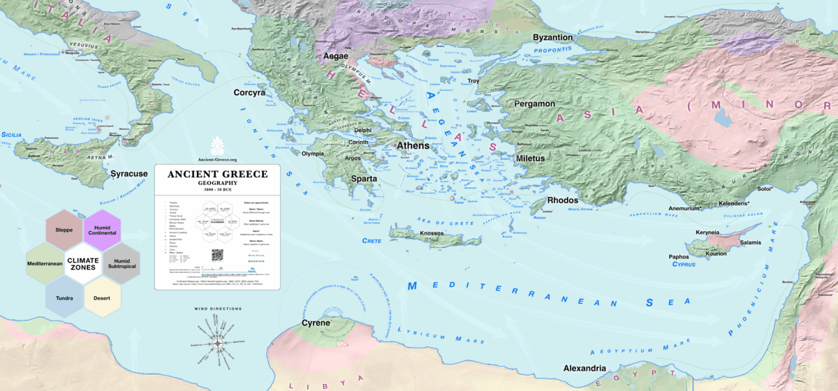
The geography and geology of Greece (Greek: Γεωγραφία και Γεωλογία της Ελλάδας, Geografía kai Geología tis Elládas) are defined by a deeply fractured, mountainous landscape situated at the convergent boundary of the African and Eurasian tectonic plates. This dynamic environmental matrix, characterized by complex climate zones, active seismic regions, and extensive island networks, remains fundamentally the same today as it was in antiquity and profoundly shaped the historical trajectory of the ancient Hellenic world.
Η γεωγραφία και η γεωλογία της Ελλάδας (Αγγλικά: Geography and Geology of Greece) καθορίζονται από ένα έντονα κατακερματισμένο, ορεινό τοπίο που βρίσκεται στο συγκλίνον όριο της Αφρικανικής και της Ευρασιατικής τεκτονικής πλάκας. Αυτό το δυναμικό περιβαλλοντικό πλέγμα, που χαρακτηρίζεται από πολύπλοκες κλιματικές ζώνες, ενεργές σεισμικές περιοχές και εκτεταμένα νησιωτικά δίκτυα, παραμένει θεμελιωδώς το ίδιο σήμερα όπως και στην αρχαιότητα και διαμόρφωσε βαθιά την ιστορική πορεία του αρχαίου ελληνικού κόσμου.
Geological Framework and Tectonic Activity | Γεωλογικό Πλαίσιο και Τεκτονική Δραστηριότητα
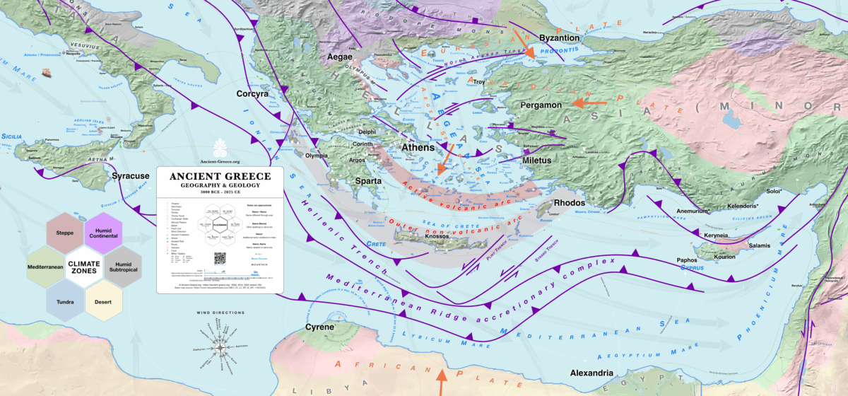
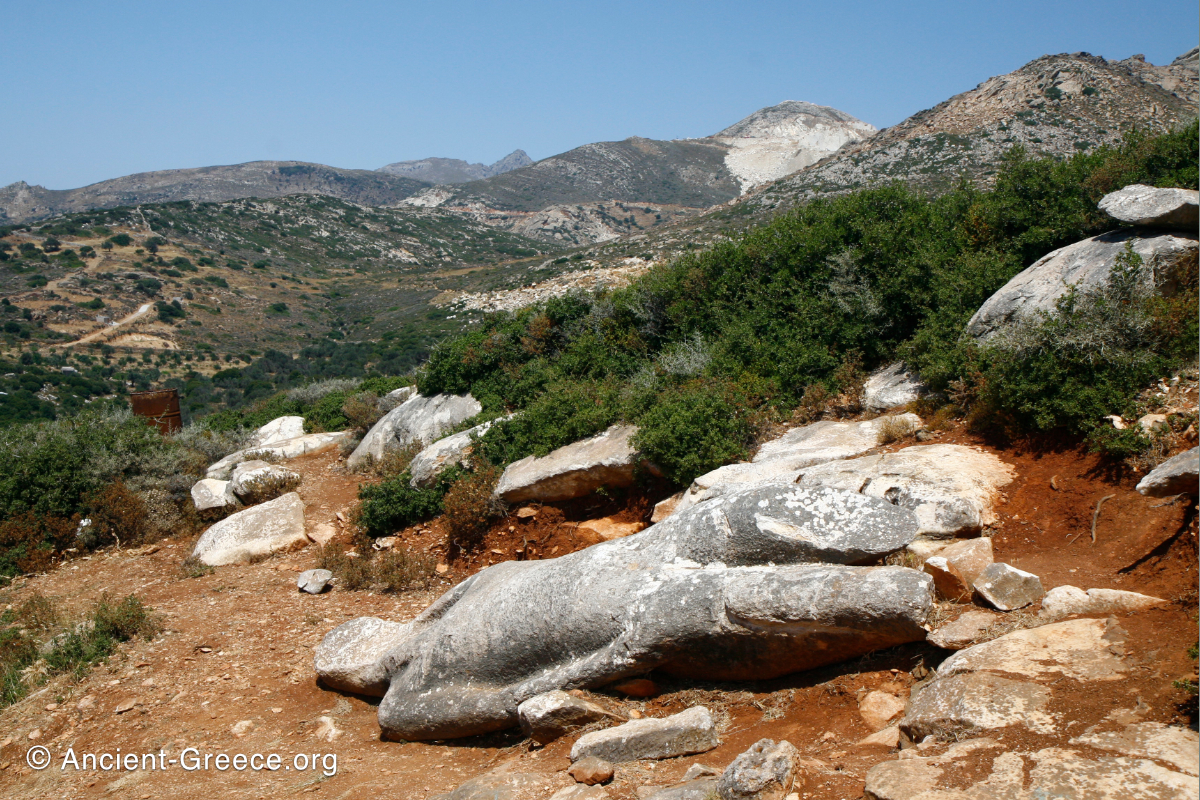
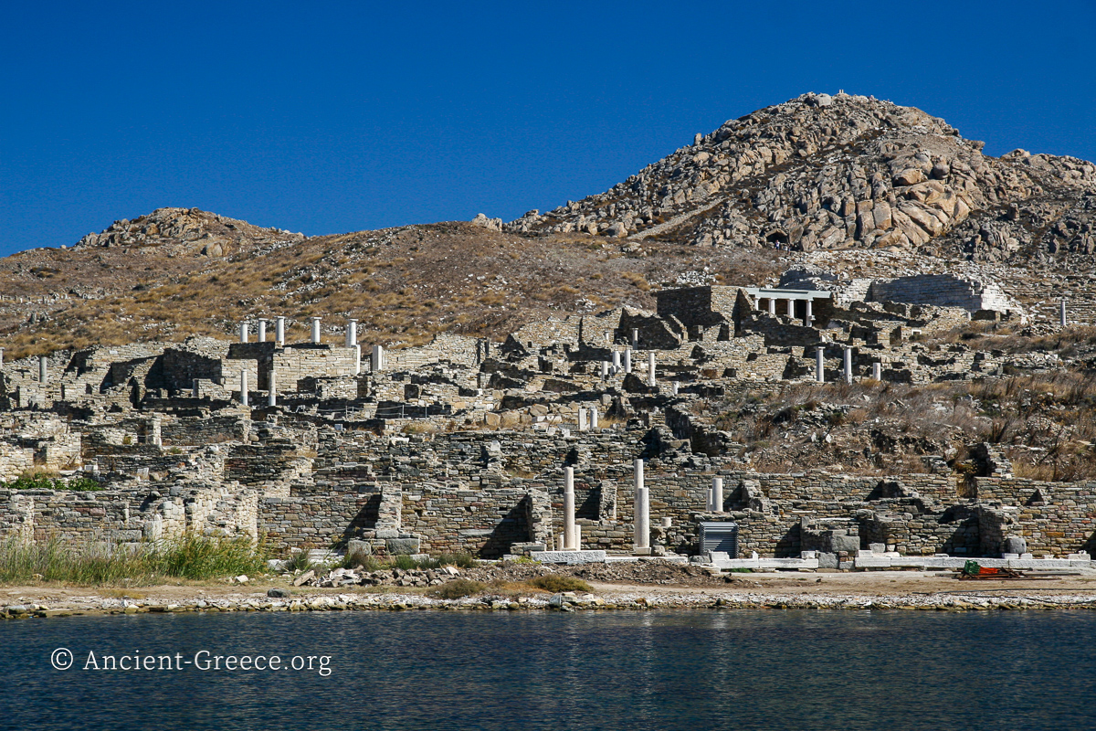
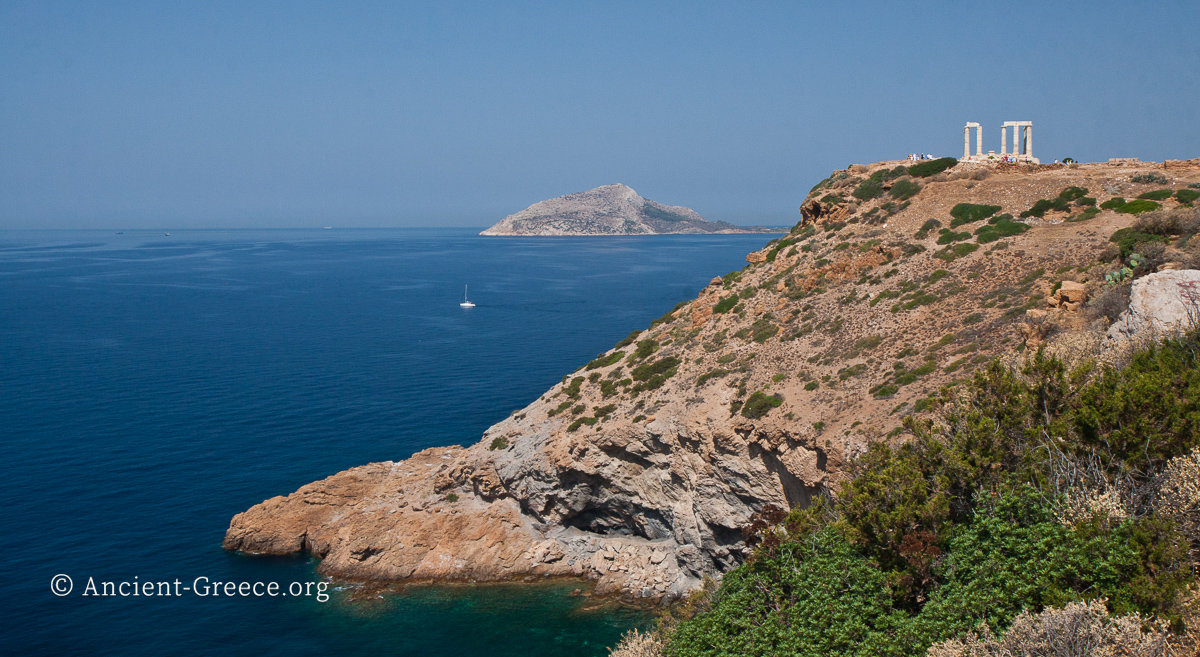
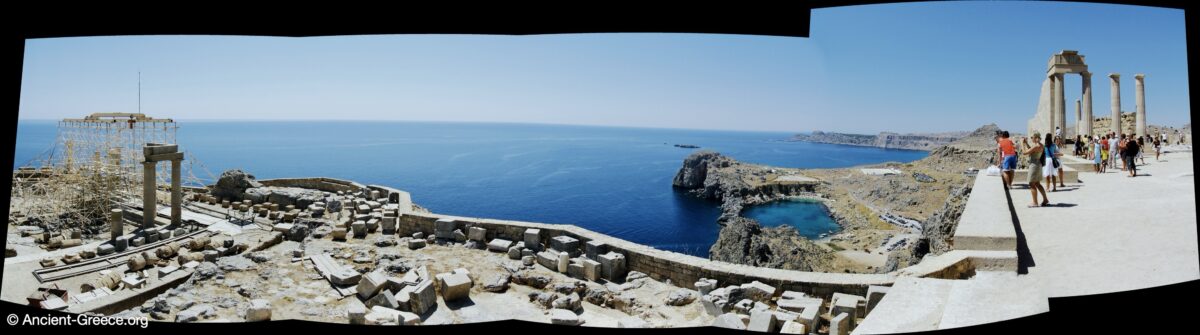
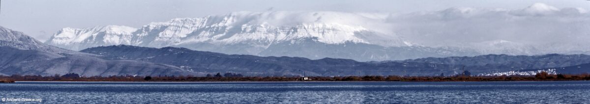
The dominant geological mechanism of the region is the subduction of the African plate beneath the Aegean Sea plate along the Hellenic Trench. This process formed the active volcanic arc—stretching from Methana through Milos, Santorini, and Nisyros—and the outer non-volcanic arc encompassing Crete and Rhodes. Consequently, the Greek mainland and archipelago are dominated by rugged limestone and marble mountain ranges, deep marine basins, and an extensive network of fault lines. This complex geology yielded rich mineral deposits, such as the silver mines of Laurion that funded the Athenian fleet, the obsidian of Milos that drove Neolithic trade, and the abundant, high-quality marble from Paros, Naxos, and Mount Pentelicus that defined Classical architecture. The widespread presence of soluble limestone created an extensive karst topography, forming complex subterranean drainage systems and powerful perennial springs that dictated the placement of prominent sanctuaries like Delphi and the Athenian Acropolis. Concurrently, the constant threat of seismic activity and volcanic eruptions frequently disrupted settlements and profoundly influenced the religious consciousness of the ancient Mediterranean.
Ο κυρίαρχος γεωλογικός μηχανισμός της περιοχής είναι η υποβύθιση της Αφρικανικής πλάκας κάτω από την πλάκα του Αιγαίου κατά μήκος της Ελληνικής Τάφρου. Αυτή η διαδικασία σχημάτισε το ενεργό ηφαιστειακό τόξο—το οποίο εκτείνεται από τα Μέθανα μέχρι τη Μήλο, τη Σαντορίνη και τη Νίσυρο—και το εξωτερικό μη ηφαιστειακό τόξο. Κατά συνέπεια, η Ελλάδα κυριαρχείται από τραχιές οροσειρές ασβεστόλιθου και μαρμάρου και βαθιές θαλάσσιες λεκάνες. Αυτή η πολύπλοκη γεωλογία απέδωσε πλούσια κοιτάσματα ορυκτών, όπως τα ορυχεία αργύρου του Λαυρίου που χρηματοδότησαν τον αθηναϊκό στόλο, τον οψιδιανό της Μήλου, και το άφθονο μάρμαρο από την Πάρο, τη Νάξο και το Πεντελικό. Η ευρεία παρουσία διαλυτού ασβεστόλιθου δημιούργησε μια εκτεταμένη καρστική τοπογραφία, σχηματίζοντας υπόγεια συστήματα αποστράγγισης και ισχυρές πηγές που υπαγόρευσαν τη θέση ιερών όπως οι Δελφοί και η Αθηναϊκή Ακρόπολη. Παράλληλα, η συνεχής απειλή σεισμών και ηφαιστειακών εκρήξεων επηρέασε βαθιά τη θρησκευτική συνείδηση της Μεσογείου.
Climate, Architecture, and Open-Air Worship | Κλίμα, Αρχιτεκτονική και Υπαίθρια Λατρεία
The region’s Mediterranean climate, defined by hot, dry summers and mild, wet winters, established a strict agricultural calendar centered on the “Mediterranean triad” of wheat, olives, and grapes. The timing of planting and harvesting, alongside the pastoral practice of transhumance, was inexorably linked to these seasonal shifts. Furthermore, this benign, predictable climate heavily influenced Hellenic architecture and religious practices. The assurance of warm, dry weather for much of the year facilitated the development of unroofed public spaces, courtyards, and stoas that dominated civic life in the agora. Religious worship was similarly externalized; rituals, festivals, and sacrifices were predominantly conducted at open-air altars situated outside the temples, seamlessly integrating the natural landscape into the spiritual life of the polis.
Το μεσογειακό κλίμα της περιοχής, που καθορίζεται από θερμά καλοκαίρια και ήπιους χειμώνες, καθιέρωσε ένα αυστηρό γεωργικό ημερολόγιο επικεντρωμένο στο σιτάρι, την ελιά και το αμπέλι. Επιπλέον, αυτό το ήπιο, προβλέψιμο κλίμα επηρέασε έντονα την ελληνική αρχιτεκτονική και τις θρησκευτικές πρακτικές. Η εξασφάλιση ζεστού, ξηρού καιρού για το μεγαλύτερο μέρος του έτους διευκόλυνε την ανάπτυξη υπαίθριων δημόσιων χώρων, αυλών και στοών που κυριαρχούσαν στην αγορά. Η θρησκευτική λατρεία ήταν ομοίως εξωτερικευμένη· οι τελετουργίες, οι γιορτές και οι θυσίες διεξάγονταν κυρίως σε υπαίθριους βωμούς έξω από τους ναούς, ενσωματώνοντας το φυσικό τοπίο στην πνευματική ζωή της πόλης.
Maritime Dominance and Economic Unification | Θαλάσσια Κυριαρχία και Οικονομική Ενοποίηση
Because the rugged terrestrial topography made overland travel arduous and fragmented populations into independent city-states (poleis), the sea functioned as the primary highway. The specific conditions of the Mediterranean—with its predictable seasonal Etesian winds and relatively short distances between landmasses—were ideally suited for the development of galleys. These shallow-draft vessels, powered by oars and sails, could easily navigate coastal waters and beach on sandy shores. This environment facilitated the rise of early maritime empires, or thalassocracies, most notably that of Minoan Crete during the Bronze Age. By the Iron Age, advancements in open-sea navigation catalyzed a massive wave of colonization (apoikiai). This expansion ultimately unified large parts of four major sea basins—the Mediterranean, the Ionian, the Aegean, and the interconnected Bosporus, Black Sea (Euxine Sea), and Sea of Azov—into a cohesive economic network. During the Classical and Hellenistic eras, the dominance of the central and eastern Mediterranean was secured by vast fleets of swift triremes and heavy merchant ships, moving bulk goods and establishing a unified spread of Hellenic culture that continues to resonate to the present day.
Επειδή η τραχιά χερσαία τοπογραφία κατακερμάτισε τους πληθυσμούς σε ανεξάρτητες πόλεις, η θάλασσα λειτούργησε ως η κύρια οδός. Οι ειδικές συνθήκες της Μεσογείου ήταν ιδανικές για την ανάπτυξη των γαλερών. Αυτά τα σκάφη με μικρό βύθισμα, κινούμενα με κουπιά και πανιά, μπορούσαν εύκολα να πλοηγηθούν στα παράκτια ύδατα. Αυτό το περιβάλλον διευκόλυνε την άνοδο πρώιμων θαλάσσιων αυτοκρατοριών, ή θαλασσοκρατιών, με πιο αξιοσημείωτη τη Μινωική Κρήτη κατά την Εποχή του Χαλκού. Μέχρι την Εποχή του Σιδήρου, οι εξελίξεις στη ναυσιπλοΐα πυροδότησαν ένα μαζικό κύμα αποικισμού. Αυτή η επέκταση ενοποίησε τελικά μεγάλα τμήματα τεσσάρων μεγάλων θαλάσσιων λεκανών—της Μεσογείου, του Ιονίου, του Αιγαίου, και του διασυνδεδεμένου συστήματος Βοσπόρου, Εύξεινου Πόντου και Θάλασσας του Αζόφ—σε ένα συνεκτικό οικονομικό δίκτυο. Κατά την Κλασική και Ελληνιστική εποχή, η κυριαρχία εξασφαλίστηκε από τεράστιους στόλους τριήρων και εμπορικών πλοίων, καθιερώνοντας μια ενοποιημένη εξάπλωση της ελληνικής κουλτούρας που συνεχίζεται μέχρι σήμερα.
Cultural Impact, Navigation, and Scientific Advancement | Πολιτιστικός Αντίκτυπος, Ναυσιπλοΐα και Επιστημονική Πρόοδος
The inescapable realities of geography deeply permeated ancient Greek culture, fostering a profound preoccupation with maritime themes and long voyages. From the Bronze Age onwards, the sea was both a vital lifeline and a formidable adversary, a duality immortalized in epic poetry through the concept of nostos (the perilous homeward journey) central to Homer’s Odyssey. Moreover, the absolute necessity of mastering maritime navigation and predicting cyclical agricultural seasons drove rigorous observation of the natural world. This maritime and cyclical activity directly fueled foundational advances in astronomy, geometry, and mathematics as navigators and farmers sought to map the stars and calculate the seasons. The epitome of this scientific mastery is the Antikythera mechanism, an ancient Greek hand-powered orrery and analogue computer designed to calculate astronomical positions and eclipses, reflecting a civilization that successfully quantified the mechanical rhythms of its environment.
Οι αναπόδραστες γεωγραφικές πραγματικότητες διαπέρασαν την αρχαία ελληνική κουλτούρα, ενισχύοντας μια βαθιά ενασχόληση με ναυτικά θέματα. Από την Εποχή του Χαλκού, η θάλασσα ήταν ταυτόχρονα ζωτική γραμμή ζωής και τρομερός αντίπαλος, μια δυαδικότητα που απαθανατίστηκε στην επική ποίηση μέσω της έννοιας του νόστου που είναι κεντρική στην Οδύσσεια του Ομήρου. Επιπλέον, η ανάγκη για ακριβή ναυσιπλοΐα και πρόβλεψη των γεωργικών εποχών οδήγησε στην αυστηρή παρατήρηση του φυσικού κόσμου. Αυτή η ναυτική και κυκλική δραστηριότητα τροφοδότησε άμεσα θεμελιώδεις προόδους στην αστρονομία, τη γεωμετρία και τα μαθηματικά. Η επιτομή αυτής της επιστημονικής δεξιοτεχνίας είναι ο Μηχανισμός των Αντικυθήρων, ένας αρχαιοελληνικός αναλογικός υπολογιστής σχεδιασμένος για τον υπολογισμό αστρονομικών θέσεων, αντανακλώντας έναν πολιτισμό που ποσοτικοποίησε επιτυχώς τους μηχανικούς ρυθμούς του περιβάλλοντός του.
Chapters | Κεφάλαια
This history of Ancient Greece is divided into the following chapters: | Αυτή η ιστορία της Αρχαίας Ελλάδας είναι χωρισμένη στα ακόλουθα κεφάλαια:
- Timeline | Χρονολόγιο
- Introduction | Εισαγωγή
- Overview | Επισκόπηση
- Geography & Geology | Γεωγραφία & Γεολογία
- Stone Age | Λίθινη Εποχή
- Bronze Age | Εποχή του Χαλκού
6.2 Minoan | Μινωικός Πολιτισμός
6.3 Mycenaean | Μυκηναϊκός Πολιτισμός - Iron Age | Εποχή του Σιδήρου
7.1 Geometric or Dark Age | Γεωμετρική ή Σκοτεινή Εποχή
7.2 Archaic Era | Αρχαϊκή Εποχή - Classical Era | Κλασική Εποχή
- Hellenistic Era | Ελληνιστική Εποχή
Related Pages
Bibliography
- Geology of Greece – Wikipedia https://en.wikipedia.org/wiki/Geology_of_Greece
- The Obsidian Trade in the Prehistoric Aegean – Penn Museum Expedition Magazine
- Laurion and the Athenian Economy – World History Encyclopedia
- A Geological Companion to Greece and the Aegean – Higgins, Michael D., and Reynold Higgins. Cornell UP, 1996.
- The Role of the Physical Environment in Ancient Greek Seafaring – Morton, Jamie. Brill, 2001.